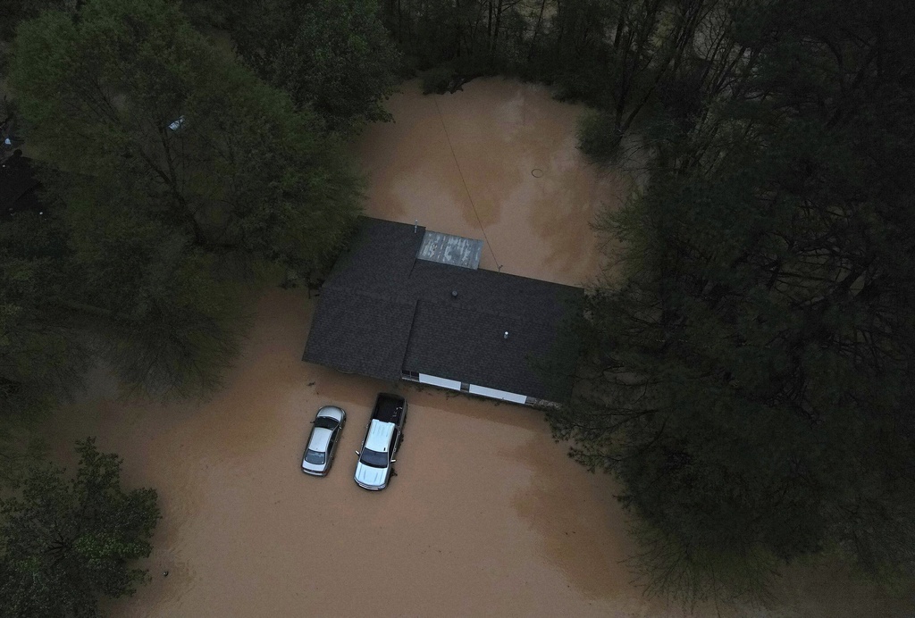
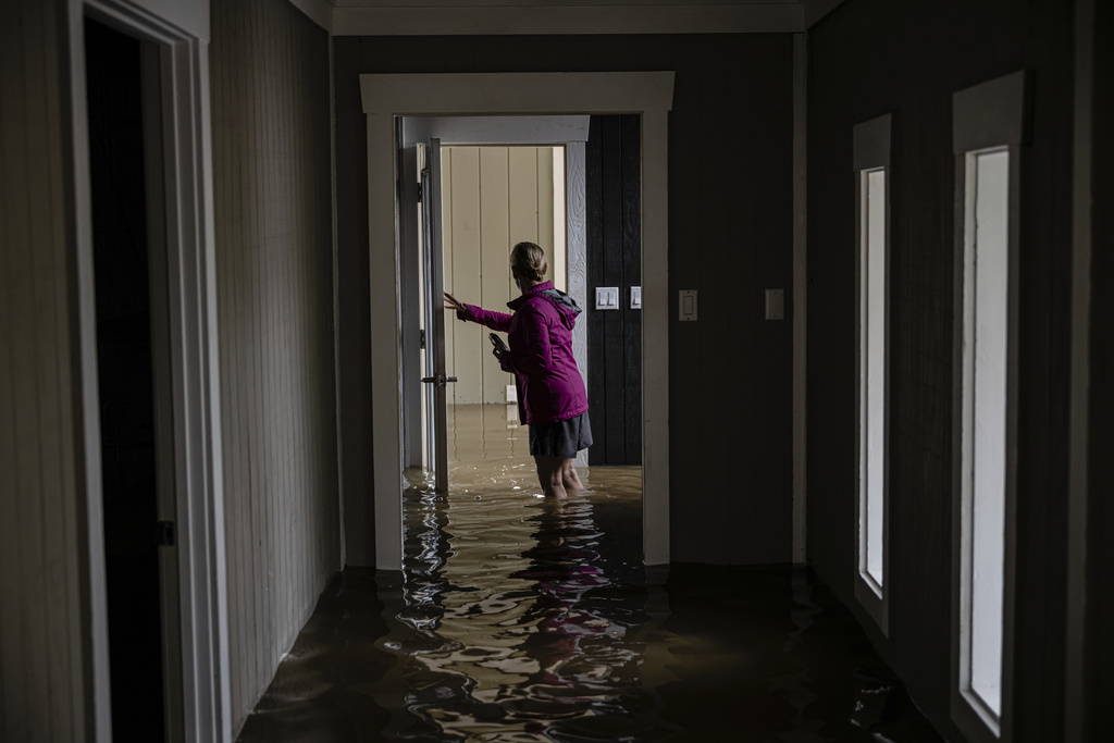
Deadly Storms Bring Flood Emergencies Across Central U.S. \ Newslooks \ Washington DC \ Mary Sidiqi \ Evening Edition \ Relentless storms brought torrential rains and flash flooding across the South and Midwest. Several tornadoes destroyed neighborhoods, with at least nine deaths reported. Floodwaters disrupted infrastructure, prompted evacuations, and triggered major delays in transportation and commerce.

Quick Looks
- Torrential rains triggered flash floods in Missouri, Texas, Arkansas, and Kentucky
- At least 9 people killed, including children and the elderly
- 45 rivers expected to reach major flood stage, according to NWS
- Massive impact on interstate commerce in Louisville and Memphis
- Flash flood emergencies declared in multiple southern states
- Falmouth, KY, evacuated as Licking River swells toward record levels
- Washed-out railway bridge in Arkansas derailed BNSF train
- Weather attributed to Gulf moisture, unstable atmosphere, wind shear
Deep Look
The central United States is reeling under the weight of a relentless barrage of torrential rain, flash flooding, and violent tornadoes that have battered the region for days, pushing rivers past flood stage, uprooting communities, and tragically claiming lives. On Saturday, this severe weather saga took another dangerous turn as saturated grounds gave way to more flash floods, tornadoes intensified, and officials raced to issue emergency warnings across multiple states.
This latest outbreak comes after a week of heavy storms that have dropped over a foot of rain in parts of Kentucky and more than eight inches in Missouri and Arkansas. The saturated conditions have created a high-risk environment for flash flooding, landslides, and infrastructure failure. Entire neighborhoods have been destroyed, transportation routes crippled, and communities forced to evacuate — all while many areas remain under persistent threat.
A Human and Environmental Catastrophe
As of Saturday evening, officials confirmed at least nine deaths directly linked to the severe weather. Seven people lost their lives in tornadoes that obliterated homes and businesses, while two others drowned in Kentucky floodwaters. The victims include a 9-year-old boy swept away by a surging creek on his way to school and a 74-year-old man found in a submerged vehicle in Nelson County. These fatalities underscore the unpredictable and swift nature of flash flooding, particularly in hilly or low-lying areas.
Kentucky Governor Andy Beshear described the conditions as some of the worst the state has seen in recent memory, noting that hundreds of roads were closed due to high water, mudslides, or fallen trees. The Little River receded slightly in Hopkinsville on Saturday, briefly reopening parts of downtown, but more rain loomed on the horizon.
Elsewhere in Kentucky, emergency officials issued a mandatory evacuation for Falmouth, a small town of 2,000 situated along the Licking River. Memories of the town’s catastrophic 1997 flood — when the river reached a record 50 feet and destroyed over 1,000 homes — still haunt the region. Saturday’s river forecasts prompted fears of a repeat disaster.
Tornadoes Leave Trails of Destruction
Tornadoes have wreaked havoc from Missouri to Tennessee. In Selmer, Tennessee, a tornado packing winds of up to 160 mph flattened entire residential blocks, leaving behind a scene of shredded homes, toppled trees, and power outages. Tennessee Governor Bill Lee confirmed the destruction, stating, “Entire neighborhoods have been completely wiped out.”
The National Weather Service reported multiple confirmed tornadoes across Missouri and Arkansas on Friday. In one of the more dramatic observations, radar picked up debris being lofted 25,000 feet into the air near Blytheville, Arkansas — a clear indicator of a powerful twister on the ground.
The Arkansas Emergency Management Division reported storm-related damage across 22 counties, ranging from wind damage and hail to widespread flooding. Many areas remain under watches and warnings as officials brace for continued severe weather into Sunday.
Infrastructure Under Siege
Beyond the immediate human toll, the storms have placed immense pressure on transportation and logistics infrastructure. Rail lines, highways, and cargo hubs have all suffered major disruptions. In Mammoth Spring, Arkansas, a BNSF railway bridge was washed out by floodwaters, causing a partial derailment of a freight train. While no injuries were reported, officials gave no timeline for restoring rail service — a major concern for freight movement in and out of the region.
Louisville, Kentucky, home to one of the nation’s busiest cargo airports, is also feeling the pinch. The Ohio River rose five feet in just 24 hours and is projected to continue rising, threatening riverfront industry, homes, and commercial logistics networks. Louisville Mayor Craig Greenberg warned residents that this could be “one of the top 10 flooding events in city history.”
Meteorologist Jonathan Porter from AccuWeather said the flooding across critical transportation corridors like Louisville and Memphis could lead to widespread shipping delays and supply chain disruptions — an increasingly common consequence of extreme weather in the U.S.
Understaffed Forecasting in a Time of Crisis
Compounding the problem is the strain on the very system meant to predict and warn about these disasters. Nearly half of National Weather Service forecast offices are currently experiencing 20% staffing shortages — double the vacancy rate of just a decade ago. These shortfalls stem in part from staffing cuts during the Trump administration and ongoing challenges in recruitment and retention.
With severe weather patterns increasing in frequency and intensity, experts warn that this shortfall could hinder timely warnings and adequate preparation for storms, particularly in rural areas.
Why the Weather Has Been So Extreme
Meteorologists attribute this outbreak of extreme weather to a combination of factors that, together, created a volatile and dangerous setup. Warm spring temperatures clashed with an unstable upper atmosphere and strong wind shear, while a deep plume of moisture from the Gulf of Mexico fueled intense rainfall and storm development. These ingredients have persisted for days, allowing storm systems to repeatedly train over the same regions, compounding rainfall totals and triggering flash floods.
This phenomenon, known as “training,” is when multiple thunderstorms follow the same path — much like train cars — leading to prolonged and localized rainfall events. It has been particularly dangerous in regions like the Ozarks and Appalachian foothills, where water can cascade down hillsides into small towns with little warning.
Shelter, Fear, and Community Response
As the storms continued on Saturday, residents in multiple towns sought shelter wherever they could. In Dyersburg, Tennessee, dozens of people arrived at a storm shelter carrying what they could. George Manns, 77, was among them. He brought folding chairs, toiletries, medications, and tech devices, worried that the storm could level his apartment like the last one.
“I don’t leave them in my apartment in case it’s destroyed,” he said. “I have to make sure I have them with me.”
Communities across the region are rallying to support one another, with emergency responders, neighbors, and local officials working round-the-clock to provide shelter, food, and real-time updates. The Federal Emergency Management Agency (FEMA) is monitoring the situation, and governors from affected states have activated National Guard units to aid in evacuations and cleanup.
Deadly Storms Bring Deadly Storms Bring Deadly Storms Bring


You must Register or Login to post a comment.