Extreme Weather Hits U.S.: Floods, Mudslides, and a Polar Vortex Ahead/ Newslooks/ WASHINGTON/ J. Mansour/ Morning Edition/ The Eastern U.S. braces for severe flooding, with up to 8 inches of rain expected in Kentucky, Tennessee, and West Virginia. Meanwhile, California communities near wildfire burn scars are dealing with mudslides and debris flows. The coldest polar vortex of the season is also set to bring frigid temperatures to the northern Rockies and Plains.
Extreme Weather Threatens U.S.: Quick Looks
Flood Threat in Eastern U.S.
- Heavy rain and melting snow expected in the Ohio and Tennessee valleys.
- Kentucky, Tennessee, West Virginia, and Arkansas under flood warnings.
- Up to 8 inches of rain could trigger historic flash flooding.
- Lower Mississippi Valley at risk for severe thunderstorms and tornadoes.
California Mudslides Following Wildfires
- Sierra Madre, California, hit by debris flows after heavy rainfall.
- Mudslides damaged homes, trapped cars, and forced evacuations.
- Bulldozers clearing mud-covered roads after Eaton Fire burn scar floods.
- In Pacific Palisades, residents cleaning up after thick layers of mud coated streets.
- LAFD vehicle swept into the ocean in Malibu; firefighter escaped with minor injuries.
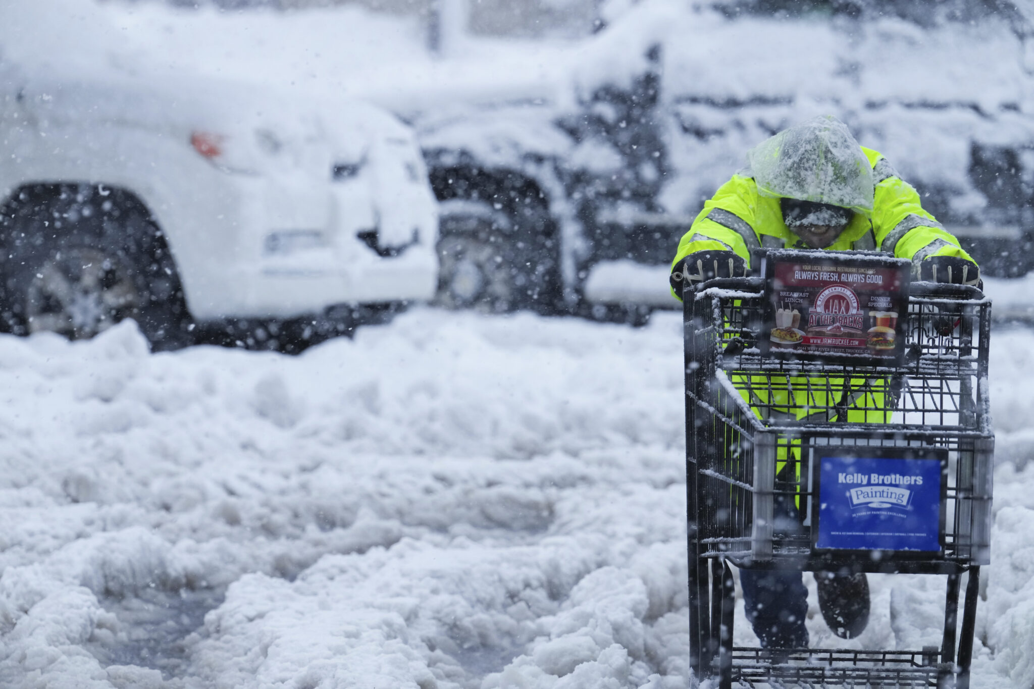
Snowstorm and Ice Threat in Northeast
- Heavy snow transitioning to sleet in New England.
- New York expected to see 6-13 inches of snow and wind gusts up to 45 mph.
- Widespread power outages and tree damage expected due to ice accumulation.
- Travel could become nearly impossible in parts of Vermont, New Hampshire, and Maine.
Coldest Polar Vortex of the Season Moving In
- Arctic air expected to hit the northern Rockies and Plains starting Saturday.
- Denver temperatures dropping to 14°F (-10°C) over the weekend.
- Emergency shelters extended in Denver, with free bus transportation to warming centers.
- Hazardous mountain travel in the Rockies as I-70 faces closures due to snow.
Floods, Mudslides, and a Polar Vortex: U.S. Faces Multiple Weather Threats
Flooding in the Eastern U.S.: “Historic Event” Possible
Deep Look
A powerful storm system is bringing widespread flooding to the Ohio and Tennessee valleys, with parts of Kentucky, Tennessee, and West Virginia facing life-threatening flash floods.
The National Weather Service (NWS) warns that western Kentucky could see up to 8 inches of rain, calling it a “major, potentially historic, flash flood event”.
Meanwhile, New England braces for a dangerous mix of snow and ice, which could lead to travel shutdowns and power outages over the weekend.
California Battles Mudslides in Fire-Scarred Communities
On the West Coast, California’s Sierra Madre community is recovering from severe mudslides, which followed heavy rains over wildfire burn scars.
- Homes and garages damaged, roads submerged in sludge.
- Evacuations ordered for at-risk neighborhoods.
- In Pacific Palisades, bulldozers worked to clear mud-covered streets.
Firefighter’s Vehicle Swept Into the Ocean
- A Los Angeles Fire Department vehicle was washed into the Pacific Ocean in Malibu.
- The firefighter escaped with minor injuries, officials confirmed.
Polar Vortex: Arctic Blast to Bring Dangerous Cold
The U.S. is set to experience its 10th and coldest polar vortex of the season.
- Rockies and Northern Plains will see temperatures plunge starting Saturday.
- Denver expected to drop to 14°F (-10°C).
- Coldest air will linger through next week, impacting Midwest and East Coast.
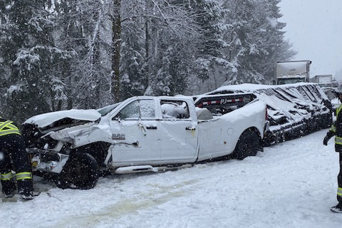
Winter Weather Closes Roads, Impacts Skiers
- Rocky Mountain travel expected to be hazardous over Presidents’ Day weekend.
- Interstate 70 already experiencing closures due to heavy snowfall.
What’s Next?
- Flash flooding likely through the weekend in parts of the Midwest and South.
- California remains at risk for additional mudslides in wildfire-scarred areas.
- The polar vortex could lead to record-breaking cold across the U.S. next week.