Francine hurricane/ Louisiana storm landfall/ Gulf Coast hurricane/ Francine storm path/ Newslooks/ BATON ROUGE/ Tropical Storm Francine is gaining strength and is expected to become a hurricane before making landfall in Louisiana on Wednesday. With storm surge warnings and the potential for life-threatening flooding, officials urge residents to prepare and evacuate if needed.
Tropical Storm Francine Nears Hurricane Status: Quick Looks
- Strengthening Storm: Francine expected to become a Category 2 hurricane before landfall in Louisiana.
- Evacuation Orders: Mandatory evacuations in seven coastal communities, including Holly Beach.
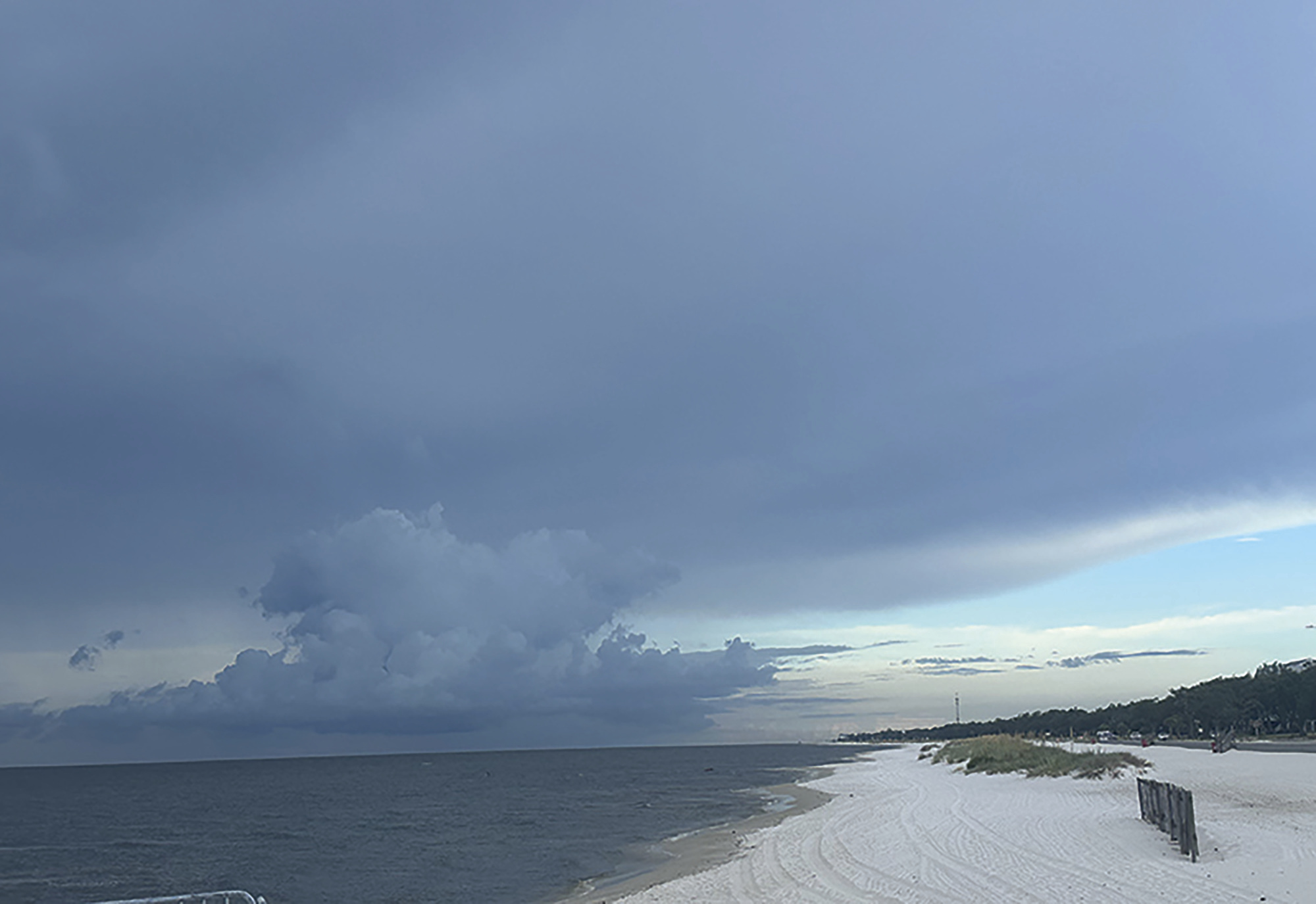
- Storm Surge Warnings: Life-threatening surges expected along the Louisiana coast, up to 10 feet.
- Rainfall Impact: Up to 12 inches of rain, causing potential flash flooding in Louisiana and Mississippi.
- New Orleans Preparation: Residents advised to shelter in place, with potential tornado activity.
Francine Nears Hurricane Strength, Louisiana Braces for Impact
Deep Look
Tropical Storm Francine continues to strengthen as it moves through the Gulf of Mexico and is forecast to become a Category 2 hurricane by the time it makes landfall on the Louisiana coast on Wednesday afternoon. As of Tuesday morning, Francine was producing sustained winds of 65 mph (100 kph) and moving north-northwest at 5 mph (7 kph), according to the National Hurricane Center.
A storm surge warning is in effect for a stretch of coastline extending from just east of Houston to the Mississippi River, including the areas south of New Orleans. Officials warn of life-threatening surges up to 10 feet in coastal communities, with the most dangerous surges expected from Cameron to Port Fourchon and into Vermilion Bay. The storm will also bring torrential rain, with projections of 4 to 8 inches across much of Louisiana and Mississippi, and localized amounts reaching 12 inches. This heavy rain could cause flash flooding and urban flooding, forecasters said.
Louisiana Governor Jeff Landry urged residents to prepare now and heed evacuation warnings. “We do not want people waiting until the last minute to get on the road and then run out of fuel,” Landry said, emphasizing the importance of advance preparation. He reminded residents that the state has been disseminating information throughout the hurricane season, stressing that preparedness is key to weathering the storm.
Francine is the sixth named storm of the Atlantic hurricane season and is heading toward a Louisiana coastline still recovering from previous hurricanes, including Laura, Delta, and Ida. Over the weekend, a 22-story building in Lake Charles—a symbol of the destruction left by Hurricanes Laura and Delta—was imploded after being vacant and damaged for nearly four years.
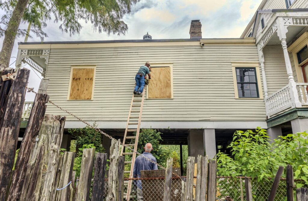
Evacuations and Preparations
Cameron Parish officials ordered mandatory evacuations for seven coastal communities, including Holly Beach, a low-lying area known as Louisiana’s “Cajun Riviera”. The storm-battered community has repeatedly rebuilt after past hurricanes. Grand Isle, Louisiana’s last inhabited barrier island, is also preparing for the worst, with Mayor David Camardelle recommending evacuation and ordering a mandatory evacuation for residents in recreational vehicles. The town is still recovering from Hurricane Ida, which destroyed 700 homes in 2021.
In Baton Rouge, Louisiana’s capital, residents were already taking precautions on Monday, forming long lines at gas stations and grocery stores to stock up on supplies. City-operated sandbag stations were also busy as residents filled sandbags to protect their homes from potential flooding. Mayor-President Sharon Weston Broome encouraged residents to gather enough food, water, and essentials for at least three days, stressing the importance of taking the storm seriously.
In New Orleans, Mayor LaToya Cantrell advised residents to shelter in place, stating that preparations should include looking out for both families and neighbors. The city is expecting up to 6 inches of rain, along with gusty winds and the possibility of isolated tornadoes. Officials said that the worst of the storm would likely hit the city on Wednesday and Thursday.
The Storm’s Path
As of Tuesday, Francine was located about 120 miles south-southeast of the Rio Grande, and about 415 miles south-southwest of Cameron, Louisiana. The storm is expected to move northward, skirting the coasts of northeastern Mexico and southern Texas before making landfall in Louisiana.
The approaching storm is already having an impact on parts of northern Mexico, where over a dozen neighborhoods in Matamoros, near Brownsville, Texas, experienced flooding, leading to the closure of schools. Officials in Mexico are waiting for federal support to provide pumps to drain flooded areas.
Forecasters warn that Francine’s storm surge, coupled with the possibility of heavy rainfall, could cause dangerous flooding in both coastal and inland areas. Michael Brennan, director of the National Hurricane Center, stressed the storm’s potential for widespread damage, noting that the surge and winds could extend far inland, bringing life-threatening conditions to areas away from the immediate coast.
Final Preparations
In preparation for the storm, Louisiana officials are urging residents to finalize their plans while there’s still time. Mike Steele, spokesperson for the Governor’s Office of Homeland Security and Emergency Preparedness, noted that conditions can change rapidly once a storm enters the Gulf. He emphasized that the best time to prepare is now, as waiting until the storm hits could make it difficult to evacuate safely.
“We always talk about how anytime something gets into the Gulf, things can change quickly, and this is a perfect example of that,” Steele said.
Residents are reminded that flooding, high winds, and power outages are all likely impacts as the storm makes its way toward Louisiana. With landfall expected on Wednesday, state officials will continue to monitor and update the situation.