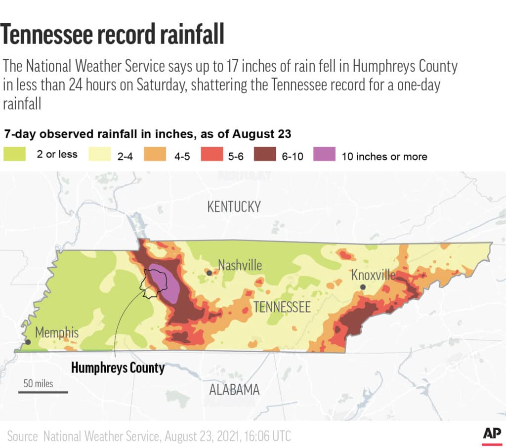
The huge rainstorm that hit central Tennessee doesn’t happen very often, but there have been four significant flood events recently, happening nearly every six months. This most recent storm accumulated 3 to 4 inches of rain per hour. The Associated Press has the story:
Tennessee rainstorm was the ‘rare of rare’
NASHVILLE, Tenn. (AP) — A rural Tennessee community was pummeled Saturday with up to 17 inches (43 centimeters) of rain in less than 24 hours, shattering the state record for one-day rainfall by more than 3 inches and leading to quick-rushing floods that killed at least 22 people and left a trail of destruction.
The hardest-hit areas were inundated with nearly twice the amount of rain the region had seen in the previous worst-case flooding scenario, meteorologists said. Lines of storms moved over the area around the small town of Waverly for hours, wringing out a record amount of moisture — a situation scientists have warned may be more common because of global warming. The devastation centered on Humphreys County, with a population of about 18,000 some 60 miles (96 kilometers) west of Nashville.

Flood damage is seen along Simpson Avenue in Waverly, Tenn., Sunday, Aug. 22, 2021. Heavy rainfall caused substantial flooding in the Humphreys County city, with multiple fatalities and dozens missing as of Sunday morning. (Andrew Nelles/The Tennessean via AP)
HOW DID SO MUCH RAIN FALL SO QUICKLY?
A flash flood watch was issued for the area before the rain started, with forecasters saying 4 to 6 inches (10 to 15 centimeters) were possible. Before Saturday’s deluge, the worst storm recorded in this area of central Tennessee dropped more than 9 inches (23 centimeters) of rain in 2010, said Krissy Hurley, a National Weather Service meteorologist in Nashville.
She said Saturday’s storms kept redeveloping as they moved and went over the same areas repeatedly, resulting in upwards of 3 to 4 inches of rain per hour.
“In my almost 20-year career, I’ve never seen rainfall amounts and rainfall rates this high not associated with some type of hurricane or tropical system,” Hurley said. “So, to see something like this inland in Middle Tennessee is probably the rare of rare.”
The town of McEwen near Waverly was pummeled Saturday with 17.02 inches (43.2 centimeters) of rain, smashing the state’s 24-hour record of 13.6 inches (34.5 centimeters) from 1982, according to the National Weather Service in Nashville, though Saturday’s numbers still have to be confirmed.
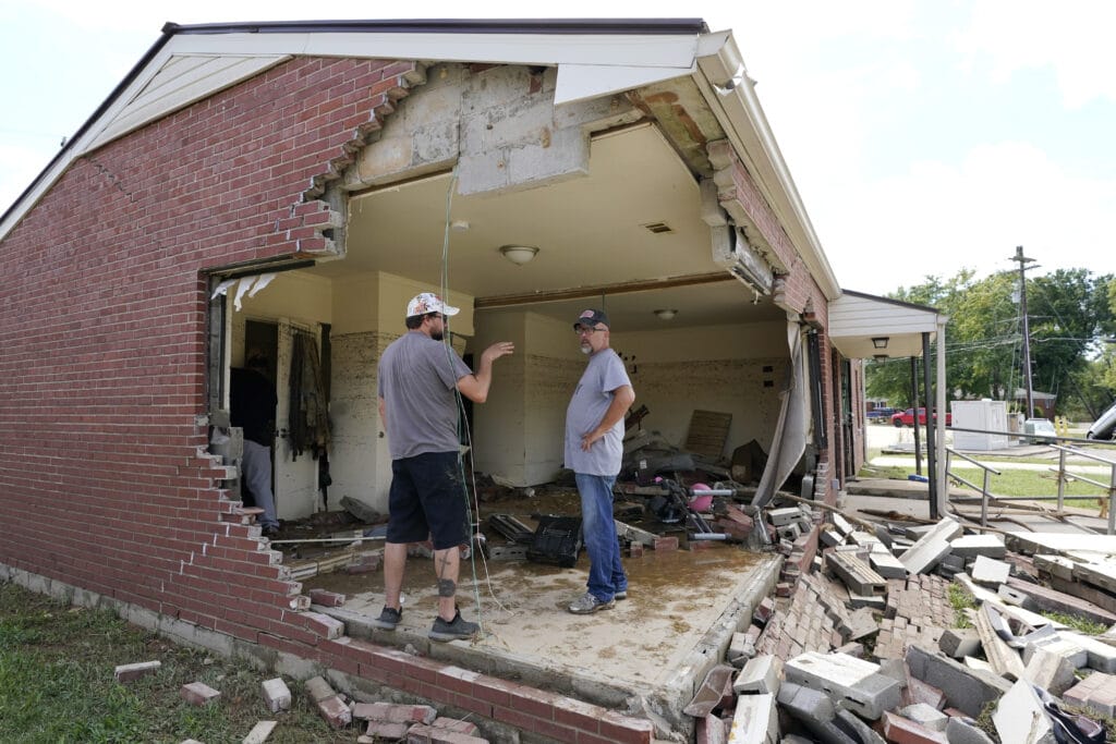
Brian Mitchell, right, looks through the damaged home of his mother-in-law along with family friend Chris Hoover, left, Sunday, Aug. 22, 2021, in Waverly, Tenn. Heavy rains caused flooding Saturday in Middle Tennessee and have resulted in multiple deaths as homes and rural roads were washed away. (AP Photo/Mark Humphrey)
WHY DID WAVERLY SEE SO MUCH DAMAGE?
The deluge left rescue teams scrambling to find those missing in Waverly, the town with the worst damage and now a landscape of collapsed houses, tangled debris and flipped vehicles strewn about town. The search was still ongoing Monday.
Because of the county’s terrain, water gushed into Waverly westward down Trace Creek from surrounding areas, some of which are several-hundred feet higher, Hurley said.
“That’s why folks who live there talk about this big wall of water that came on very quickly,” Hurley said.
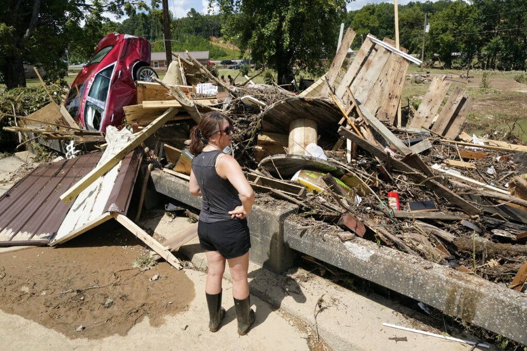
A woman looks at debris washed up against a bridge over a stream Sunday, Aug. 22, 2021, in Waverly, Tenn. Heavy rains caused flooding Saturday in Middle Tennessee and have resulted in multiple deaths as homes and rural roads were washed away. (AP Photo/Mark Humphrey)
HOW DOES CLIMATE CHANGE FACTOR IN?
Recent scientific research has determined that extreme rain events will become more frequent because of man-made climate change.
Dorian Burnette, a University of Memphis associate professor in earth sciences, said climate change has “put the atmosphere on steroids,” offering a “more robust way to get super heavy rainfall rates out of thunderstorms now when you get the right meteorological setup.”
“We’re probably going to see more of these events as time goes along and as the Earth continues to warm,” Burnette said.
A federal study found man-made climate change doubles the chances of the types of heavy downpours that in August 2016 dumped 26 inches (66 centimeters) of rain around Baton Rouge, Louisiana. Those floods killed at least 13 people and damaged 150,000 homes.
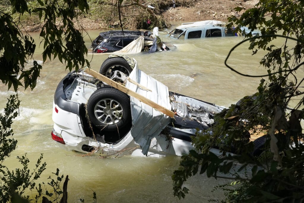
Vehicles come to rest in a stream Sunday, Aug. 22, 2021, in Waverly, Tenn. Heavy rains caused flooding Saturday in Middle Tennessee and have resulted in multiple deaths as homes and rural roads were washed away. (AP Photo/Mark Humphrey)
HOW RARE WAS TENNESSEE’S FLOODING?
Hurley said her region of Tennessee has seen four significant flood events recently, happening nearly every six months. She noted floods once expected maybe every 100 years happened last September south of Nashville and in March closer to the city.
Even so, Hurley said the rainfall over the weekend was exceedingly rare.
Waverly has endured other floods in the last decade or so, including in 2010 and 2019. The February 2019 flooding brought 10 to 12 inches of rain over two days. The weekend’s storms exceeded that amount of rainfall over an eight- to 12-hour period, Hurley said.
By JONATHAN MATTISE

